The outdoor experts at Blacks’ have put together a list of their favourite summer hikes across the UK.
Seahouses to Bamburgh: Recommended by Rebecca Everett
The 9.7km walk from Seahouses to Bamburgh is a stunning spot for photographers to go wild and is a haven for surfers and watersports enthusiasts alike. Set before soft sand dunes and studded with iconic landmarks, the Northumberland Coastline is home to some of the most immaculate and quiet coastal scenes in the country.
Loughrigg Loop: Recommended by Jack Holman from Blacks Ambleside
Starting on Skelwith Bridge, this Lake District walk is a perfect mix of flat paths and climbs up summits. The climb leads to the edge of the ridge that runs up Sergeant Man and offers views over Grasmere, Elterwater and the full northern expanse of Windemere. The walk takes an average of two to two and a half hours and ends at a cafe that offers strong coffee and a hearty slice of cake.
Clay Bank To Carlton Bank: Recommended by Mark Thompson
This four-mile route takes walkers through winding paths towards the beautiful Hasty Bank. From here, walkers get marvellous views of Roseberry Topping and Urra Moor. The Wainstones is also on this route and offers views of natural rock formations and water features. The walk has several points along the way where hikers can stop and take in their surroundings, and the Lord Stones Country Park offers cooked meals just before the final stint to Carlton Park.
Pen-Y-Ghent: Recommended by Bethany Leedham from Blacks Head Office
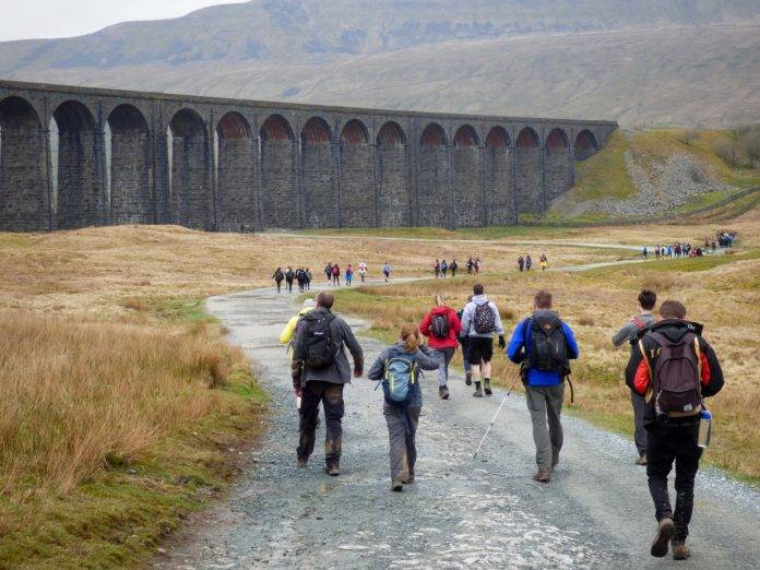
The Yorkshire Dales has many walks with beautiful scenery, and one of the most stunning summer hikes is Pen-Y-Ghent, one of the Yorkshire Three Peaks. This great circular route starts in Horton-in-Ribblesdale and is around 6.5 miles. Being the lowest of the Yorkshire Three Peaks at 694m, it’s a popular choice for hikers of all abilities and is also easily accessible by public transport if you don’t drive.
Back way to Castleton: Recommended by Ethan Ball from Blacks Head Office
This 6-mile route has everything from wide open fields to rocky scrambles, Stony cliff tops and cave-littered dales. It’s got a segment of steep elevation to its highest point at the top of Mam Tor (517m). This hike has something for everyone, is full of points of interest and can be easily tweaked to be made easier or more difficult.
A walk through stone stiles and streams take walkers to the base of the north side of Mam Tor. In summer, the steep ascent is dry and rocky enough to safely scramble up to the Great Ridge of Mam Tour. The climb offers views of green landscape rolling into the distance for miles as well as views of Hope Valley and the town of Castleton.
Once you have taken in the astounding views, a gentle slope down the south side of Mam tour will take you to Sparrowspit, and a small path takes walkers to dramatic cliff tops that look down Winnats Pass. The walk is full of grassy banks, and Cave Dale (known locally as Secret Valley) is one of the most beautiful examples of this.
The walk finishes in the cottage-lined village of Castleton, where you can have a hearty meal and a well-deserved drink after your hike.
Pembrokeshire Coast Path (St Davids Head to Aber Pwll): Recommended by Chrissy Raider
This section of the Pembrokeshire Coastal Path is a breathtaking stretch of coastline that encapsulates the natural beauty and rugged charm of Wales. Walkers are lucky enough to see panoramic views of the Celtic Sea, with its azure waters stretching as far as the eye can see. The rugged cliffs, carved by centuries of wind and waves, are a sight for sore eyes providing a dramatic backdrop to the pristine beaches below.
The path takes hikers to Aber Pwll, where salt marshes and mudflats provide a haven for wild birds. The section from St Davids Head to Aber Pwll is a true gem along the Pembrokeshire Coastal Path. Whether you seek adventure, solitude, or simply an opportunity to connect with nature, this segment will leave an indelible mark on your memory.
Harting Downds to Amberly: Recommended by Aaron Jewell
The South Downs Way in East Sussex hosts a range of walks, with Hartign Downds to Amberley being a firm favourite. Starting at the remote car park of Harting Downs, a 10-minute drive from nearby Petersfield, the trail nearly entirely follows the South Downs way for 18 miles and approx 2000ft of total ascent enjoying stunning views over the South Downs from start to finish.
A climb over Beacon Hill takes hikers away from the South Downs Way for one mile, awarding them with a stunning view over the rolling hills of the South Dows.
As you descend the other side back down the well-signposted trail of the SDW, you enjoy constant sweeping views of the countryside. Starting early is fantastic, walking head-on towards a stunning sunrise. At the end of the hike, as you descend to the river Arun running through Amberly, you can find a café or pub to refuel and a train station to retreat home. There is also an option to extend your walk by following the river to the beautiful town of Arundel and its many coffee shops.


